Educational Resources

There are a number of educational resources developed through the DRY project and About Drought programme which span the breadth of the curriculum. For more information visit the DRY Utility Learning pages.

KS2 – DRY: The Diary of a Water Superhero

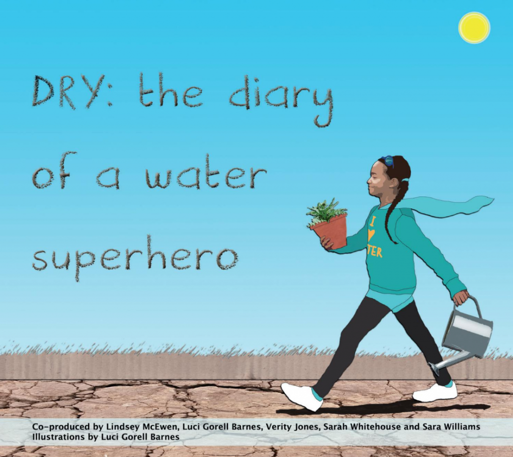
A bright, engaging story book has been produced for use in primary schools, with accompanying teacher’s notes and is due for publication later this year (2019). Designed to inform children to become champions to change behaviour, ‘DRY: Diary of a Water Superhero’ follows the story of an ordinary schoolgirl who becomes a water hero during a drought in the UK. The thought-provoking storyline encourages class discussions on how we treat water and how we can all save water as well as including activities.

The book, its concept and storyline were co-produced by Prof Lindsey McEwen, Luci Gorell Barnes, Verity Jones, Sarah Whitehouse and Sara Williams as part of About Drought, with illustrations by Luci Gorell Barnes.

Front cover of the book, DRY: the water diary of a superhero

The e-book, DRY: Diary of a Water Superhero is available to read online in English and Welsh

The book is also free to download in both English and Welsh.

The writing team have also run a couple of webinars to introduce the DRY Primary book resource – one for ‘educators’ and another for ‘parents and carers’.

Teachers’ Notes which accompany the DRY Primary Book were also developed.

KS3&4 – All About Drought Geographical Association resources

The DRY and About Drought programme have collaborated with the Geographical Association to develop research-informed resources that promote awareness of UK drought among young people. This includes creative thinking about positive water behaviours at home and in school, and adaptation to future drought.

We have worked with educational developer, Gemma Mawdsley to develop six lesson plans and learning resources for Key Stages 3 and 4 which are available from the Geographical Association.

For older students: Water Futures

Water Futures is an interactive visualisation tool stringing together several different models, which allows users – including students under guidance – to explore how water resources move throughout London. Models in general allow researchers, engineers and decision makers to envision different possible scenarios or outcomes. The models used in this tool are from Thames Water, a weather model from the University of Bristol and a water resources model from the University of Oxford called the WATHNET model. Water Futures was developed by the MaRIUS project working with Thames21, a community project that aims to provide education, improve rivers and improve the quality of life of people in the community by enhancing waterway environments.

Conversation starters: Understanding ‘Hidden’ or ‘Embedded’ Water

When thinking about personal water use, it is important to differentiate between direct water use and use of ‘virtual’, hidden or ‘embedded’ water in the growing and processing of the food we eat, the clothes we wear, and the items we use in our daily lives. The DRY project used the ‘hidden water’ quiz as a ‘conversation opener’ to engage children and adults about water behaviours – as a way in to talking about experiences of dryness and drought.

          Food water challenge questions

          Food water challenge answers

          Food water challenge teachers notes

The DRY project found that this quiz was particularly popular with school teachers and those running scout and brownie groups.

For more information about these materials and many more produced by the DRY project please visit the DRY Utility.

Jamie Hannaford, Principal Hydrologist, Centre for Ecology & Hydrology

Early warning forecasts – a real success story!

“Since September 2018 we have been providing bespoke hydrological forecasts for the Environment Agency’s area teams based on their reasonable worst-case scenarios and stress test scenarios … it is a real success story.”

Jamie Hannaford, Principal Hydrologist, Centre for Ecology & Hydrology

A key need addressed by About Drought has been improved access to early warning information, especially for hydrological forecasting. 

Since 2013 a Hydrological Outlook had been provided by the UK Centre for Ecology & Hydrology (UKCEH)the Met Office and BGS, producing a static document that gives a 1-page summary for the UK as a whole, followed by regional and national information. But that did not allow users to access a forecast for the particular river in the UK that they were interested in. 

Under About Drought that has become possible. Our project IMPETUS aimed to improve drought forecasting for decision-makers, building on information gathered at a host of stakeholder workshops to establish current practices and their needs across water supply, health, power, agriculture, navigation and recreation. 

New insight into likely river flows 3 months ahead

It developed a new methodology of forecasting and the follow-on project ENDOWS gave researchers the opportunity to develop IMPETUS’ methods. Now an insight into hydrological conditions over the coming three months, with likely trajectories for flows in 300 rivers around the UK and groundwater levels is available.

Jamie Hannaford, ENDOWS’ Principal Investigator and Principal Hydrologist at UKCEH, says: “The science was done in IMPETUS. We tested the methods, validating them to see how reliable and accurate they are around the country and at different times of the year. 

“Then in ENDOWS we opened up the forecasts and operationalised that system to the extent that these hydrological forecasts are now available in the first few days of every month. 

Since the summer of 2018 we have worked with a very wide range of stakeholders, providing them with forecasts for the river catchments that are relevant and ensuring that they meet user needs. In last summer’s drought conditions when many stakeholders needed reliable information about what would happen next, they have told us that these forecasts were very useful.”

Bespoke forecasts for EA and Yorkshire Water

The forecasts have been provided to a wide range of users, including water companies, the Environment Agency (EA)Natural Resources Wales, the Scottish Environment Protection Agency, the National Farmers’ Union, energy industry and the Canal & River Trust

Jamie adds: “Since September 2018 we have also been providing bespoke hydrological forecasts for the Environment Agency’s area teams based on their reasonable worst-case scenarios and stress test scenarios. They have been used internally and for National Drought Group briefings – it is a real success story.

“In the dry spell of Summer 2018 we started providing hydrological outlooks to Yorkshire Water who wanted to specifically look at the likelihood of reaching certain flow thresholds for their internal management, and we came up with a bespoke outlook for them. 

“These are just two examples that illustrate the benefit of having the extra ENDOWS knowledge exchange and synthesis funding for the programme. It has enabled the excellent science from IMPETUS to fulfil its potential, it gave researchers the time to hear directly from stakeholders how it could be used, to refine our outputs to make them user-friendly, for example through data visualisation. 

“We listened and as a result they were able to use them to access better information in a live situation in the 2018 drought. Users said they were pleased to see that this project produced such useful information, and that there is a pathway for this science to be continued after ENDOWS, through the Hydrological Outlook.”

Published October 2019

Searchable information sources

Searchable information sources for use by different audiences:

  • DRY Utility provides several tools to help you find the information you are looking for.
  • Story Bank contains over 350 stories which can be searched via keywords.
  • Story Maps can be searched via seven geographic areas or six sectors.
  • Explore provides useful statistics and keyword searching capability.

Drought and woodlands

Woodland modelling undertaken by Dr Pam Berry and colleagues at the University of Oxford has explored in the impact of climate change on the distribution of key woodland species in Great Britain. The resultant datasets map changes in the drought vulnerability for 12 tree species and for two periods, the 2030s and the 2080s. Six categories of potential natural vegetation are also mapped for (i) the present, (ii) the 2030s and (iii) the 2080s. The modelling shows potential changes in leaf area, net primary productivity and net ecosystem productivity.   A spatial explorer interface is in development, which allows users to explore these maps interactively, including zooming into their particular location, and allows the user to swipe between two periods for a given location. If you would like to be included as a beta tester for the explorer, please email nevil.quinn@uwe.ac.uk.

Economic value of supplemental irrigation in England and Wales StoryMap

screenshot of UWE StoryMap

Irrigation is an essential component of crop production to meet retailer demands for premium quality when rainfall is insufficient. Under drought conditions, irrigation can be constrained by water resources availability, with consequent impacts on yield, quality and revenue. Whilst most agriculture in Europe is rainfed, greater dependence on supplemental irrigation could become more important in humid environments due to a changing climate with greater rainfall uncertainty and higher frequency of droughts.

This interactive StoryMap explores the total financial benefit of outdoor irrigated production in England and Wales assuming no constraints in resource availability and optimal irrigation practices. The analysis suggests that the total net benefits of irrigation in a dry year are around £665 million. Map outputs highlight significant regional differences in water productivity reflecting the composition of land use and the importance of crop mix in determining economic value. A sensitivity analysis to changes in agroclimate, market conditions (crop prices) and water supply (costs) illustrates how the benefits might change under contrasting scenario. The study highlights the importance of supplemental irrigation, even in a humid climate, and the risks that future droughts and/or constraints in water resource availability might have on agricultural systems, livelihoods and the rural economy.The StoryMap is based on a paper, “Modelling and mapping the economic value of supplemental irrigation in a humid climate“.

View the StoryMap on the UWE website.

Drought impacts explorer

Screenshot of the Beta version of the Drought impacts explorer

As part of the Historic Droughts project, researchers at Cranfield University developed an inventory of qualitative drought data related to UK agriculture based on an extensive review from two weekly farming magazines in the UK, Farmer’s Weekly and Farmers Guardian for the period 1975-2018. The resultant inventory contains over 2500 records with information on the start and end dates of the event and their location to characterise the temporal and spatial extents of the cited event, together with the text describing the driver, impact or response in relation to that event. The inventory is available to download as a csv file from the UK Data Service.

This dataset is also currently being translated in to a drought impacts explorer, which allows the user to view these records spatially and to search and save according to various criteria. If you would like to be involved in beta testing of the explorer please contact nevil.quinn@uwe.ac.uk. An early draft of the explorer is available online.

D-Risk

d-risk website screenshot

Recent droughts have highlighted the pressures on water allocations and the reliability of abstractions for irrigation.  Farm business models need to align cropping programmes to water availability – how resilient is yours to future water shocks?

D-Risk is an intuitive and free online webtool to help farming enterprises rapidly understand their business and drought abstraction risks and thereby support robust decisions regarding future investment in irrigation infrastructure, including equipment and storage reservoirs. D-Risk uses readily accessible data on your local soils, agroclimate, crop areas, irrigation plans, licences and reservoirs to assess the risk of having:

  • Insufficient headroom
  • Irrigation deficit

You can then explore:

  • Impact of licence changes
  • Modified crop mix and irrigated areas
  • Need for reservoir investment

Visit the D-Risk website